
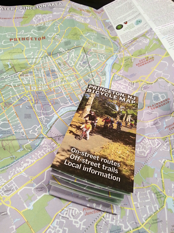
Princeton, NJ Bicycle Map
Well, here it is. The Princeton NJ, Bicycle Map.
And pretty informative it is too. In so many ways.
But to accentuate the positive this is a pretty good survey of the state of play of cycling facilities in Princeton.
Whether it’s an indicator of implementation a Complete Streets policy isn’t so clear.
But the Road to Hell is paved with good intentions although, sadly, this map falls short on the intentions.
It would be nice to see some sort of documented commitment to say, safe, controlled crossings for the D&R Canal path on Harrison, Washington and Alexander roads. And if you’re going to advise that certain roads are “not advisable” – say, Route #206 and Cherry Valley Road – then indicate that some sort of solution is envisaged. And as for Safe Routes to School … No insights here.
So this is a description of what is, or at least, thought to be. But don’t discount the aspirational view of what a map can be.
Ignorance of the issues is rife, even in a hoity-toity Ivy League, company town like Princeton. And you realise that just sayin’ you’re a Complete Streets Community doesn’t mean a thing unless you’re going to turn words into actions. And, of course, I realise that a certain demographic of the Princeton illuminati regard the streets as a parking lot for their frightful soirées.
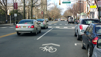
A car(e)worn sharrow …
Complete Streets is so much more than Talkin’ The Talk and Walkin’ The Walk.
Just as long as we realise the Princeton, NJ, Bicycle Map is just the start of the beginning.
Available, while stocks last, at Jay’s Cycles, Kopp’s and Halter’s Cycles.